
7/13 Update
Summer is here and it is FLYING by. We have been pretty bad about updates and posts, but that’s just the way she goes. Sorry ‘bout dat.
First off: Alpine Alleycat
What a fun ass day on the bike. Everyone seemed like they truly had a good time and for most people it was their first event like that. The scavenger hunt type vibe brought out a great mix of people with all different goals and ambitions. We loved that. Lots of people rode trails they’d never ridden before and saw some new sights. We hit the lottery with great weather and made some fun memories. The wheels are already turning for next year. Can’t believe some of y’all skipped the pizza stop at Alpine.
Next: The Vail 86er
As some of you may have seen on a couple social posts, we’ve had to change the route due to some insane dust levels on Red & White. While we absolutely love being up there, there’s really no reason to subject everyone to surfing on sand for miles and miles when we could be riding lovely (though still dusty, do your rain dancing) trails across the valley. As such, there’s a bit of a connector from Vail to Avon on the bike path. We know some people will be ‘racing’ this. PLEASE PLEASE PLEASE be respectful when riding the path. There will likely be a ton of tourists, children, and people paying 0% attention on this segment. Keep your head on a swivel and watch out for cars crossing the path. There are two resupply options right on route. The first one you will hit is the little market in Lionshead, the next one is the Shop-N-Hop in along Highway 6 in Avon. Both of these stores are well stocked and have anything you could need. At the bottom of Arrowhead around mile 67 there should be water available if the bar is closed. We’ve never seen that side door locked and those bathrooms have always been open when we’ve tried them. That being said, PLEASE bring a water filter if you’re at all worried about your timing. There’s a ton of water on route, you shouldn’t have an issue here. Another thing we want to mention, during previous rides we’ve seen sheep dogs in Blue Sky Basin. Specifically on the road climb out of Blue Sky to Pete’s lift. Just keep your eyes peeled and beware in there. If you have any questions at all about the route or logistics, please holler!
We’re super excited for this one! Lots and lots of variations of this route have been discussed and we think this is about as dialed as it gets given the conditions. Plan for a full day on the bike and bring everything you could need. 10hrs would be a pretty blazing fast time for this route, so keep that in mind! Lots of climbing, but also lots of really quality trail. Even you locals should find some new stuff in here :D
Boy, that was really somethin’
Thank you to everyone who showed up and threw down. We’re pretty sure everyone had a full value experience out there. Of the nearly 50 people registered, 26 wrote their name down in the notebook on Saturday morning. As far as we can tell, just a handful finished the route in its entirety including Yellow Jacket Canyon. We had a lot of scratches at Gateway & Dewey. It seems a good chunk of riders chose to modify their ride home somewhere between Dewey and Fruita cutting out sections of the Kokopelli. At least 4 riders completed the whole route minus Yellow Jacket.
For a lot of people, that was their first time on a ride like this and we love that. People definitely found new limits out there. We can safely say a lot of people raised the bar on what a hard hike-a-bike is. Ooops.
Here (LINK) you can find the results. If you’d like your name omitted from this list, please let us know and we’ll happily take it down! If anyone has any feedback (no, we will not remove Sheep Creek next year!) we’re all ears!
Westwater 200 THANK YOU!
May the 4th Update: Course Updates & Schedule
Weekend Scouting Mission:
We spent the day on Saturday finalizing the route and scouting some sections. The Ride With GPS track has been updated with course changes and pertinent POIs. Make sure you toggle that POI slider in RWGPS.
Notable route changes:
After the Cactus trailhead we’ve removed the 'trail' section and opted for the road. These trails are a horse/hike/bike alternative to the Jeep road are pretty sandy and slow going. In order for people to get to the Gateway store before it closes, We’ve opted for some 'faster' miles here.
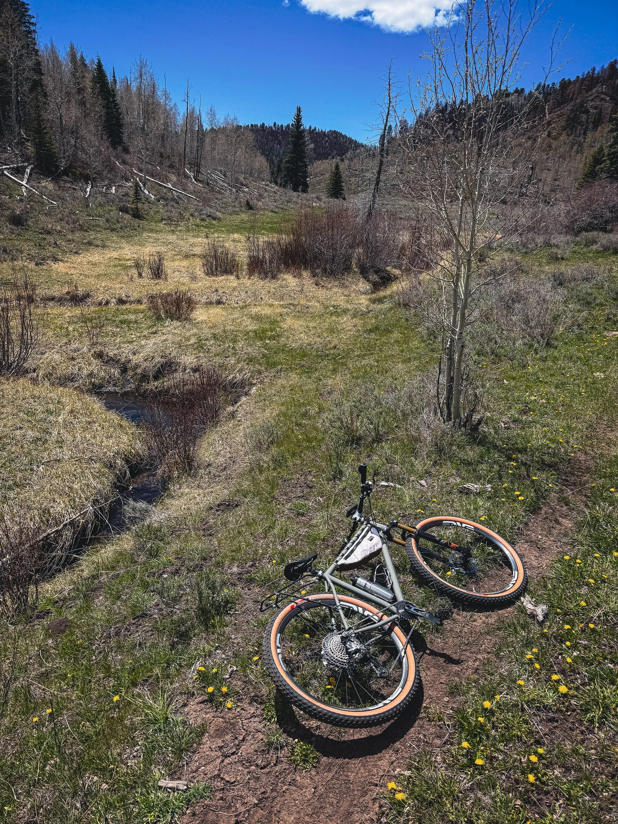
Added water POI on Little Creek. We rode this section over the weekend and it is janky. It's old and seldom used. You lose the trail for short sections and what's there is pretty overgrown. IF YOU WOULD LIKE, you can ride Cabin Creek if this is not your cup of tea. Cabin Creek is a 4x4 road that runs parallel to Little Creek. You can hop on it before Little Creek. It starts directly across from the house. Look at the route and adjust accordingly if you would like. It may actually be longer and more of a grind, but it’s a mostly ridable road vs hike-a-bike. Little Creek has the 'creek' (it's really low currently, but flowing. Photo below) running next to it to filter water. We saw zero water opportunities to filter on Cabin Creek when we came down it. It looks like Little Creek sees some cows, but we saw zero livestock during our pre-ride and every gate is wide open so we assume they're not up there yet. The top section of Little Creek is very steep and everyone will be pushing their bike for a little while. DO NOT RELY 100% ON WATER HERE. While the creek was flowing, it was 1-2’ wide in most sections. It’s unlikely it will be completely dried up in 1 week’s time, but this has been a strange season for runoff. Do not arrive here completely empty. Nothing is a given.
Water Crossing before Dewey bridge is completely fine. The Dolores is at a super low flow and if you walk the rapids and utilize the sand bar, it's just over ankle deep. Sometimes you worry about something all winter and it's just a complete non issue when the time comes... ha!
We have routed through Yellowjacket canyon after Dewey. We spoke to some bikepackers and they said it's in pretty good shape so we are going to stick to Kokopelli from Dewey to the finish with the exception of Western Rim & the railroad grade to the Westwater campground. If you are absolutely cooked, low on water, or both, you can ride the road from Dewey. We ain’t judgin’.
Water Spigot at the Westwater boat ramp is ON! Fill yer jugz.
We have removed some singletrack through the Rabbit Valley area. It's pretty boring, sandy, moto'd out.
We have moved from Mack Ridge to the OG Kokopelli route through the Koko trail system at the very end. You’re welcome.
Schedule of Events:
Friday:
Meet & Greet @ Basecamp
155 N Mulberry St, Fruita, CO 81521
5-7PM
Zero obligation, chill, say hello, meet your fellow riders, get some grub in ya.
Saturday:
Event Start @ 7AM
Circle Park, Fruita
125 W Aspen Ave, Fruita, CO 81521
4/1 Update: Reg & various ramblings
As soon as we published the google form the names started rolling in. Love to see it.
We’re getting a lot of inquiries about the water crossing. Here’s the deal. We will absolutely, under no circumstances, send you across the Dolores if we are even remotely concerned with safety. Yes, this is supposed to be hard and self supported but we’re not interested in swimming events. The other simple fact is that we have had a strange winter and no one knows what runoff is going to look like. Given that the Dolores is roughly 120mi/11.5k into the ride, we want to be sure there’s zero concern as people will no doubt be fatigued. We will scout the river crossing the week before the event and see how things are going. We will likely also check on it the Friday before the event to make our final call. We have a re-route in the hopper should the river be raging. The last time we crossed it we drove a 4×4 and it was pretty shallow and very mellow.
The only place we suspect any other route deviations may happen is above Unaweep canyon coming into Gateway. Those trails have been closed and will not open until just prior to the event. We did all the scouting we could over the winter but couldn’t ride these so there’s a little bit of uncharted territory there. Little Creek, Rim, & Ute Trails are the current route and it will likely stay that way.
Gateway General Store
The posted hours are 9AM-6PM. This gives you 11ish hours to get from Fruita to Gateway before they close. That’s 82mi and 7k feet of climbing. You’ll want to hit this resupply as it’s the only one on route. There’s some really fast miles at the start of this route, however, there’s also slow chunk between Whitewater & Gateway.
That’s it for now. Please don’t hesitate to reach out if you have any questions. Registration link can be found on the Westwater page.
2/8 Update: Getting up to speed & how we got here
Scouting. Scouting. More Scouting.
Third time is the charm? Almost.
We’ve been out west three times to scout this route. The first time we were on cloud nine with how sweet the route was. Then we hit private property. This wasn’t apparent when snooping around online. The google earth images looked like it went. There was historical heat map data showing people cutting through this field. It didn’t go. The gate that blocked our path seemed like a new addition. We tried getting around it from multiple angles with no luck. Oh well. Back to the drawing board.
Fast forward a few weeks and we’re back out west. This time with a revised (and longer) route heading in the opposite direction. Scouting the route from Whitewater to Gateway was a treat. There’s some lovely country out there. We put eyes on all we could given trail closures and snow. We’ll have to spend some time out west prior to race day to get eyes on the single track, but it looks GOOD from what we can see! The ride down into Gateway should be a real treat.
Resupply in Gateway will be a welcome sight. This little general store is well stocked with all the goodies. They even had RC Cola tall boys!
From there we called it. We would be back for another trip out west to scout from the Dewey Bridge site to the top of the Sheep Creek climb. The Sheep Creek section is on Trailforks, MTB Project, RWGPS, etc. We aren’t worried about that for the time being. It definitely seems well established.
ROUND THREE. Back in the saddle. We drove out to Dewey and pushed south & east. Damn. Another dead end. University of Utah owns a small sliver of the course that has no alternate option. ARG. Back to the maps. There’s a way to go directly south out of Gateway that avoids the Sheep Creek climb all together. This jumps on the Kokopelli trail a lot earlier and will serve as our backup plan should the Dolores be impassable at the time of the race.
As long as everything goes to plan, from the top of Sheep Creek we’ll follow some dirt roads and eventually make our way to Dewey Bridge. This DOES involve a water crossing, however, we’ll put eyes on both crossing options prior to the race to make sure the runoff is manageable.
Before heading home we stopped in Rabbit Valley and scouted the Western Rim trail. This is a super pretty section of trail and is an awesome addition to the route.
At this point we’re pretty hands off until the week before the event. If we have any other updates we’ll add them on social channels as well as here. If you have any questions don’t hesitate to get in touch with us. DM. Email. Whatever works.